Ogham 3D - CIIC 275. Drumlohan IV, Co. Waterford


Ogham 3D - CIIC 275. Drumlohan IV, Co. Waterford
Published 2016-08-04T17:20:01+00:00
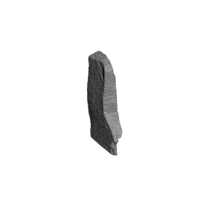
Drumlohan IV ogham stone, Co. Waterford
The following has been copied from the Ogham in 3D website: https://ogham.celt.dias.ie/stone.php?lang=en&site=Drumlohan&stone=275._Drumlohan_IV&stoneinfo=description
Description
Site
Souterrain discovered on removing the outer bank at NW of an Early ecclesiastical site. Ten ogham stones were used in the construction of the rectangular chamber (Moore 1999, 151, 172-3) - five as lintels, which are now removed and placed upright beside the souterrain, and five as lining stones for the sides, which are still in position.
Monument
'The sixth lintel'. Greenstone, 1.49m x 0.34m x 0.17m (converted from Macalister 1945, 271).
Text
'Inscription on three angles (up-down-up), and in good condition, except for is fractureof the top of the stone, which has carried off the middle of the third word... After the N a mistaken B-score had been blocked out: it was not deepened, and the A was cut over it. The first A of ..SALAR is broken away, and the space between the scores of the L in CELI is flaked. If there were such a name as Crisalar, it would exactly fill the vacant space, but this is not a suggested restoration - only an indication of the length of the damaged word ' (Macalister 1945, 271-2).
Commentary
-
The personal name CUNALEGEA contains the commonly occuring element CUNA- 'dog, hound' (McManus 1991, 102).
-
A rare example from Ireland of the Latin convention of writing QV for Q in Irish names in the Latin alphabet: QVECI = QECI? cp. MAQVI for MAQI (McManus 1991, 126)
-
This is the only known example of the sequence X MAQQI Y CELI AVI Z (McManus 1991, 171 n17)
Locations
Found
Discovered used as the sixth lintel of a souterrain (Macalister 1945, 271) in townland of Drumlohan and barony of Decies without Drum. (GPS coordinates -7.465370, 52.163318)
Last Recorded
Erected beside the souterrain on site at Drumlohan. The present location of this stone may be accessed via the National Monuments Service public map viewer on www.archaeology.ie.
History of Recording
Discovered in 1867 but ogham inscriptions not fully read until souterrain was dismantled in 1936 (Macalister 1945, 267).
References
- Kirwan, E. M. (1987): 'Drumlohan: A survey of its antiquities', Decies 35, pp 33-40.
- Kirwan, E. M. (1985): 'The Ogham stones at Drumlohan, reconsidered', Decies 28, pp 6–12.
- Macalister, R.A.S. (1945): Corpus inscriptionum insularum Celticarum, pp 267-70, 271-2.
- McManus, D. (1991): A guide to ogam. Maynooth Monographs 4, pp 102, 126.
- Moore, M. (1999): Archaeological Inventory of County Waterford. Dublin, pp 151, 172-3.
- Rhys, J. (1899): 'The Drumlohan ogams', JRSAI 29, pp 390-403.
Websites and Online Databases
- CISP (Celtic Inscribed Stones Project): www.ucl.ac.uk/archaeology/cisp/database/
- Monasticon Hibernicum database - Early Christian Ecclesiastical Settlement in Ireland 5th to 12th Centuries: monasticon.celt.dias.ie


Layer Height:0.15mm
| Date published | 04/08/2016 |
| Tempo per farlo | 130 - 150 Minuti |
| Quantità di filamento | 21.07g |
| Dimensioni | 21.85mm x 48.97mm x 130.00mm |
| Tecnologia | FDM |
| Supporto Gratuito | YES |
| Title | Ogham 3D - CIIC 275. Drumlohan IV, Co. Waterford |